Loading...
El Salvador · Eastern region · SV-US
Usulután department
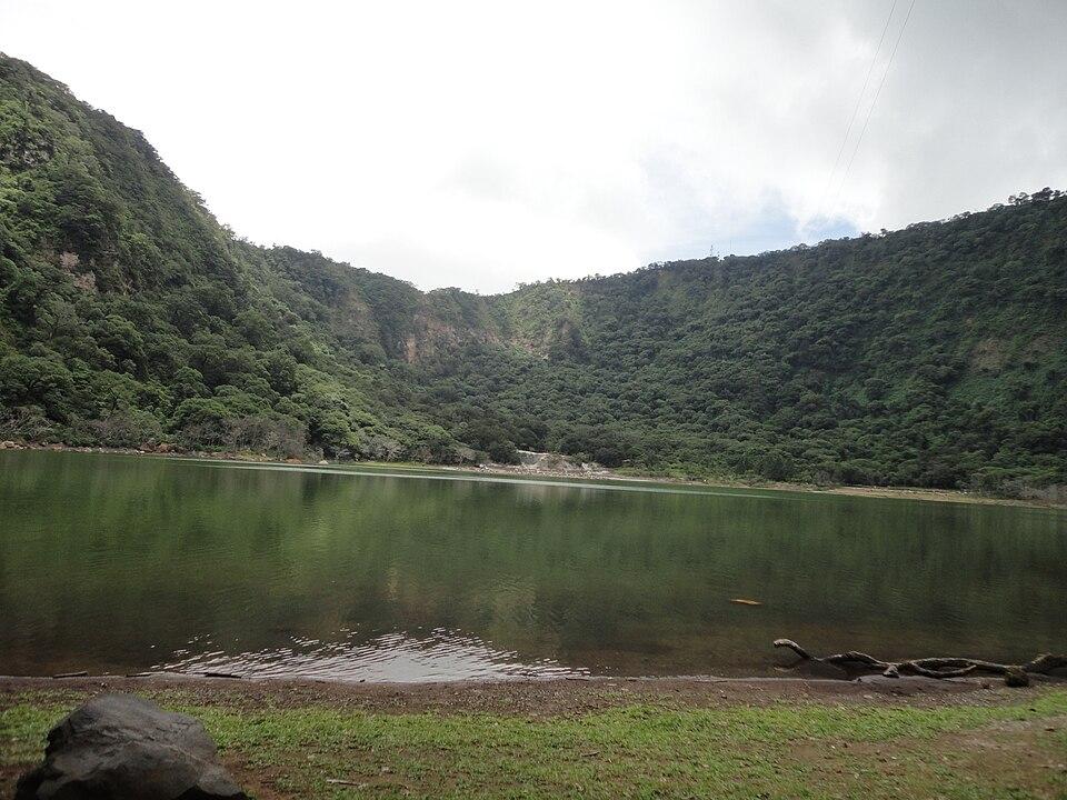
The largest department by area: the mountain town of Alegría and its crater lagoon, down to the Bahía de Jiquilisco.
- Capital
- Usulután
- in Usulután Este
- Population, 2024 census
- 325,494
- BCR census
- Area
- 2,130.44 km²
- DIGESTYC
- Municipalities / districts
- 3 / 23
- since May 1, 2024
Places to visit in Usulután
Each place is in Usulután under the 2024 municipal map (its district is shown). Pins use coordinates from OpenStreetMap, Wikidata or Wikipedia; open any place in OpenStreetMap to check it.
Usulután
City · District of Usulután, Usulután Este
The department capital, in an agricultural valley in the southeast. Source: Wikipedia
Alegría
Town · District of Alegría, Usulután Norte
Mountain town on the Tecapa volcano; a road from the town reaches the crater lagoon. Source: Wikipedia (es)
Laguna de Alegría
Nature · District of Alegría, Usulután Norte
Lagoon in the crater of the Tecapa volcano, surrounded by hot springs and fumaroles; Gabriela Mistral called it the "Emerald of America". Source: Wikipedia (es)
Berlín
Town · District of Berlín, Usulután Norte
Mountain town founded in 1885 and named by a German settler, Serafín Brennen. Source: Wikipedia (es)
Santiago de María
Town · District of Santiago de María, Usulután Norte
District of Usulután Norte with 17,940 people in the 2024 census. Source: Wikipedia (es)
Puerto El Triunfo
Town · District of Puerto El Triunfo, Usulután Oeste
Port on the Bahía de Jiquilisco, founded in 1875 to export coffee. Source: Wikipedia
Isla San Sebastián
Island · District of Usulután, Usulután Este
Pacific island in the department of Usulután. Source: Wikipedia (es)
Good to know
- The Bahía de Jiquilisco, on whose shore Puerto El Triunfo stands, is a mangrove bay and biosphere reserve, listed as a Ramsar wetland of international importance on October 31, 2005. Wikipedia (es), Wikipedia
- Money: El Salvador uses the US dollar. Bitcoin is still legal, but since the January 2025 reform to the Bitcoin Law businesses accept it only if they choose to, so carry dollars. The government Chivo wallet is no longer state-run: the IMF reported in September 2026 that its majority ownership and operation were transferred to a private operator. El Diario de Hoy, IMF
Municipalities and districts of Usulután
Since May 1, 2024 (Decreto 762), Usulután has 3 municipalities. The 23 former municipalities are now districts inside them.
Usulután Norte
Alegría, Berlín, El Triunfo, Estanzuelas, Jucuapa, Mercedes Umaña, Nueva Granada, San Buenaventura, Santiago de María
Usulután Este(capital)
California, Concepción Batres, Ereguayquín, Jucuarán, Ozatlán, Santa Elena, San Dionisio, Santa María, Tecapán, Usulután
Usulután Oeste
Jiquilisco, Puerto El Triunfo, San Agustín, San Francisco Javier
ia.sv guides
Ask ia.sv about Usulután
Each question opens in the chat, ready to edit or send.
Sources
- Population: BCR, Population and Housing Census 2024 (department totals exclude people deprived of liberty).
- Area: DIGESTYC, Statistical Yearbook 2009 (area by department).
- Municipalities, districts and capital: Legislative Decree 762, Special Law for Municipal Restructuring (2023).
- Place coordinates: OpenStreetMap (ODbL), Wikidata (CC0) and Wikipedia; districts checked against OpenStreetMap boundaries. Each description cites its source next to the place.
Checked November 17, 2026. ia.sv is independent and not affiliated with the Government of El Salvador.